By STU JOHNSON
CREDIT ENR.COM
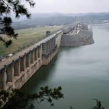
The state has announced a new online mapping tool to help local officials and first responders develop emergency response plans for high hazard dams.
The interactive map on the Kentucky Water Maps Portal website identifies the approximate area, or inundation zone which could be effected if a dam failed.
The online program uses satellite imagery to identify properties, roads, and geographic areas that could potentially be impacted. It recognized nearly 3000 business structures and almost 14,000 residences within the state’s high hazard dam inundation zones.
These dam-related hazard classifications are categorized by their potential to flood houses and businesses in the event of a failure, but not by their physical condition.
Division of Water Assistant Director Carey Johnson says this map is the first step of an outreach strategy to promote greater dam related risk awareness. The maps can be viewed at watermaps.ky.gov
People like you value experienced, knowledgeable and award-winning journalism that covers meaningful stories in Central and Eastern Kentucky. To support this locally-produced content, please consider making a contribution.
